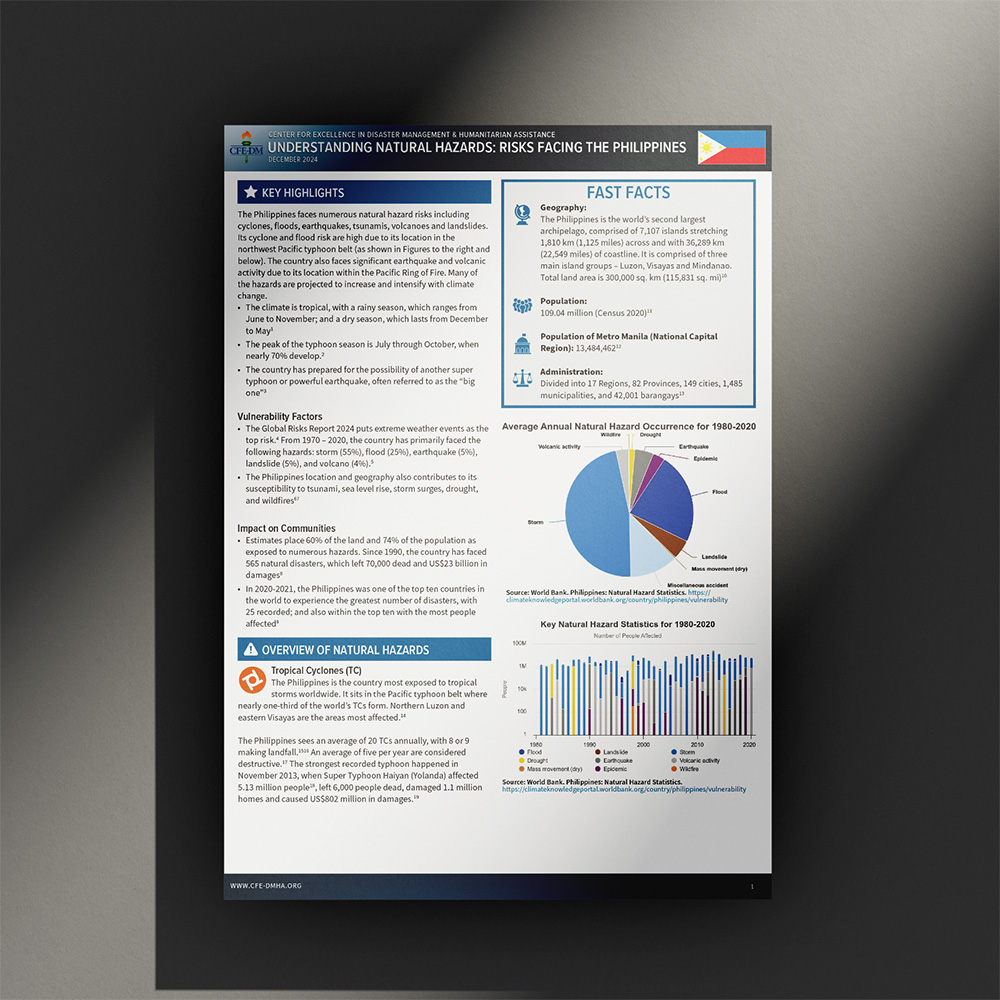
These 2-4 page fact sheets on disaster response in the Indo-Asia-Pacific are designed with a clear, structured layout that balances concise text with impactful visuals. Infographics and data visualizations play a key role in summarizing critical information, including the most common disaster types, major risks, and key response agencies in each country. Each fact sheet features a country profile with high-contrast maps, hazard frequency charts, and response frameworks to provide disaster planners with a quick yet comprehensive reference. Strategic use of color-coded sections, icons, and bold typography ensures readability and allows for rapid identification of key details. Designed for both print and digital distribution, these fact sheets serve as an essential tool for decision-makers, offering a visually intuitive and information-rich resource to enhance preparedness and response efforts across the region. Currently there are 8 country hazard fact sheets that are uploaded to the CFE-DM website for distribution.
-
Tools
Indesign
Photoshop
Illustrator
PowerPoint (for data driven inforgraphics and charts)